Author photo

By Bob Valen 

Here's what it takes to put out our local weather forecast


Last updated 7/12/2022 at 8:55pm

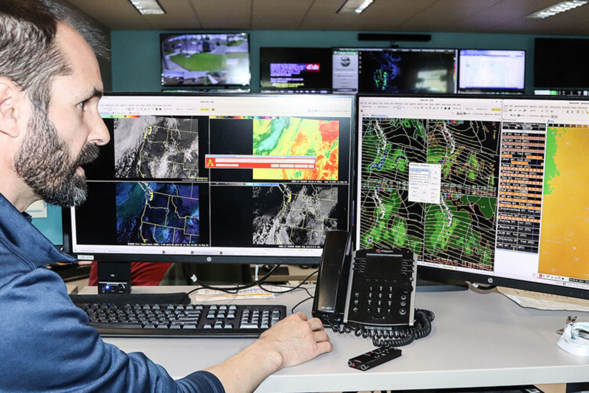
Forecaster Steven Van Horn shows some of the information available for generating weather forecasts at the Spokane office of the National Weather Service. - Bob Valen photo

There are some who have what it takes. I'm not talking about outstanding pro athletes, astronauts, or mountaineers. I am talking about weather forecasters. I recently visited the Spokane National Weather Service office and spoke with Steven Van Horn, a forecaster a that office. He has what it takes.

Van Horn shared with me the requirements needed to become a weather forecaster.

"I went to University of California, Davis to get my bachelor's degree in atmospheric science." He explained that courses in calculus through diferential equations and linear algebra are needed. Physics courses and chemistry are required, as well.

Van Horn very explained that once these basic courses are completed, you are then prepared for the atmospheric science courses. Those courses teach you about the equations that drive our atmosphere and its dynamics. Thermodynamics are studied too. Van Horn completed his master of science degree at the University of California, Los Angeles.

When a forecast is created, Van Horn said, "There are so many tools, there is so much information out there, it's hard to keep track of it." He broke down the tools into two basic categories - observations and models. On the observation side of tools, satellite and radar data, automated weather stations, weather balloons and weather spotters are added to ground-truth weather observations. "Ground truth" is a term describing an accurate observation at ground level.

"Around here, in the West, topography plays a huge role on our weather where a microclimate may exist that we can't pick up," Van Horn said. "A weather spotter is critical for that. We release weather balloons twice a day. That gives us information vertically."

Beyond about six hours in development, weather forecasters are heavily reliant on computer models and the simulations they provide. Three major computer models are used in forecasting: the Global Forecast System (GFS), The European Center for Medium-Range Weather Forecasts (ECMWF) and the Canadian Model.

"In the models, the spatial resolution is only so fine," he noted. "Each grid point is separated by 28 kilometers (17.4 miles). In mountain country, that resolution isn't good; you need three grid points to get a very crude idea of that feature."

There are processes used to create higher resolution within these models, and it requires more and more computer power.

To further refine a forecast, ensemble suites create small tweaks offering a mean and a spread to a forecast.

The Weather Service office in Spokane covers Eastern Washington and the upper Western portion of Idaho.

When asked about the accuracy of a seven-day forecast, Van Horn said, "In general, we refer to the short-term forecast as the first couple of days, and the extended is from day three out to day seven. The short-term carries more confidence than the longer term."

Forecasts are updated twice in a 24-hour period, at approximately 2 a.m. and again at 2 p.m. The latest forecast is normally available with an hour or so.

Getting weather forecast information out is important, and the media helps in that arena. Van Horn said they regularly communicate with their media partners like the television stations in Spokane.

"They are a primary way of getting our message out. That's half of the battle of delivery of an effective forecast. We do speak with some of the print media, especially after a big storm."

If you have access to a computer, I encourage you to utilize the National Weather Service Spokane office website for details on your local weather. https://www.weather.gov/otx/

***

A radar unit looms behind the National Weather Service office west of Airway Heights.

Let's take a look at the weather data for June 2022. As always, these data are from my home weather station. The high temperature was 96.3˚F on the 27th, the low was 45.2 on the 15th, and our mean was 64.3. The all-time high was 112˚F in 2021; the all-time low was 36˚F in 2008; and the all-time mean is 65.6˚F. I measured 2.56 inches of rain for June 2022. The all-time maximum was 4.29 inches in 1937. The all-time mean precipitation for June is 1.02 inches.

I spent some time perusing through the National Achieves recently. My search was for historic weather observations taken as close to Grand Coulee as I could find. To my surprise, I found weather observations from Fort Spokane. The years are 1883 through 1890, minus 1885. Straight-line distance to Fort Spokane from the Grand Coulee Dam is 31.6 miles.

Here's the June 1883 temperatures and precipitation observations at Fort Spokane: -high temperature 98˚F, low 36˚F and precipitation was 3.00 inches. I will share this historic data in the future as a month-to-month comparison. Important to remember these readings are from a location 31.6 miles away, a separate microclimate. If you know of historic weather observations closer, let me know.


Reader Comments(0)


Powered by ROAR Online Publication Software from Lions Light Corporation
© Copyright 2024