Sign outlining "Coulee Corridor" up after years of effort


Last updated 1/8/2020 at 9:23am

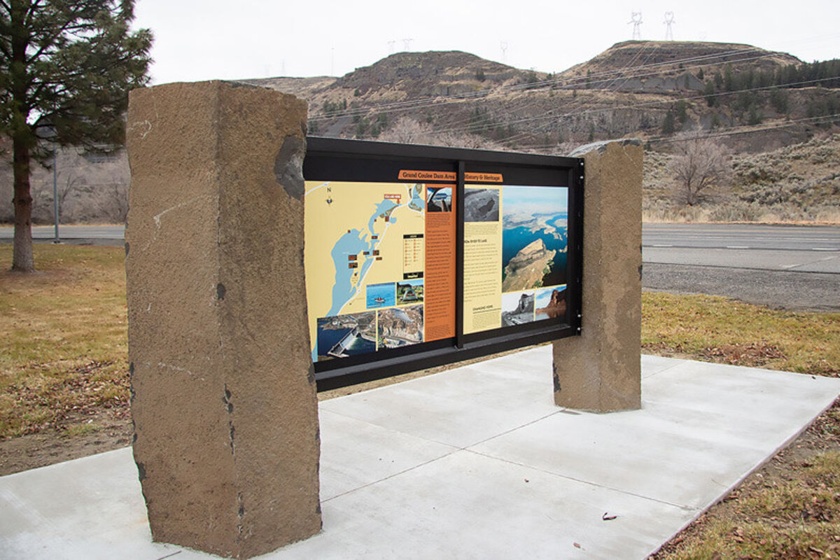
Two basalt pillars set in concrete display a new sign at North Dam Park offering information on the area, shown as part of the Coulee Corridor, a national scenic byway. - Jacob Wagner photo

Tourist and locals alike might learn a little history by stopping at North Dam Park.

Framed by basalt pillars, a kiosk detailing the Coulee Corridor National Scenic Byway was placed at North Dam Park in late December 2019 and details some of the history of the Ice Age Floods, the Grand Coulee Dam, recreation in the area, and more.

Birdie Hensley is secretary for the Coulee Corridor Consortium, which spearheaded the effort to get the sign installed, which she said they have been working on for about 10 years.

"It feels good," she said about it being installed. "It's been long coming."

Hensley explained that consortium members helped choose the pictures and details of the sign that details the Coulee Corridor, established in 1997 as a national scenic byway stretching 150 miles from Omak to Othello along SR-17 and SR-155.

"View unique landscapes shaped by water, house-sized boulders or deep vertical canyons shaped by ice age floods," the sign reads. "Check out the wildlife, recreation, and take time to learn about the varied resources."

The sign also details some of the history before Banks Lake was flooded, how water is pumped into Banks Lake, and how the irrigation systems installed over the years help water "the state's breadbasket where dozens of crops are grown."

The kiosk features local recreation areas, such as Steamboat Rock and Dry Falls, and since it is detailing a scenic byway, highlights the road that takes people to that recreation.

"Today," the sign near the north shore of Banks Lake reads, "State Route 155 carves a path between the lake edge and the eastern wall of the coulee bringing travelers to year-round fishing, hiking, rock climbing, bird watching and outdoor activities for everyone on one of the largest fresh-water lakes in the state of Washington."

The sign covers a region stretching from as far north as Omak, south through Grand Coulee, Coulee City, Moses Lake, and as far south as the Washtucna area. It includes a driving map and a recreation map focusing on the northern end of Banks Lake, as well as photos from throughout the area.

Four similar signs were placed in Warden, Soap Lake, Coulee City and Othello with some of the same information and other information unique to those places.


Reader Comments(0)


Powered by ROAR Online Publication Software from Lions Light Corporation
© Copyright 2024

Rendered 04/13/2024 09:07